
Old Nuneaton.
Browse the Collection.
Step back in time and explore our fascinating collection of historic photographs, capturing life in Nuneaton throughout the 1900s. From bustling town centre scenes and memorable community events to significant floods, large-scale demolition and town regeneration, and prestigious royal visits, these images provide a unique glimpse into the people, places, and moments that helped shape the town we know today.
Whether you are interested in local history or simply curious about how Nuneaton has changed over the years, our photographic archive offers an engaging visual record of the town's rich heritage.
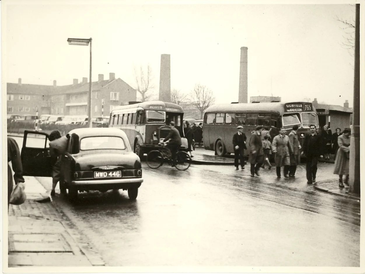
The old bus terminal is now The Close Complex opposite the Library. Dempster Court is in the background. The chimneys in the centre are the Union Wool and Leather works.
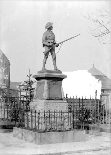
The Boer War statue fondly known as 'Old Bill' originally stood in Bond Gate alongside the river. When the Hippodrome was demolished and the road widened, 'Old Bill' was moved to Riversley Park.
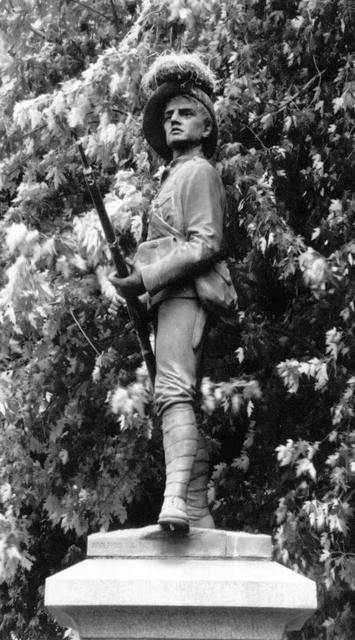
Old Bill' stood at the bottom of the bank in the Remembrance Gardens (now known as the 'Wedding Gardens' because of the proximity of the Registry Office). If you go down the steps from Vicarage Street to the gardens, 'Old Bill' stood approximately 2 metres to your right.
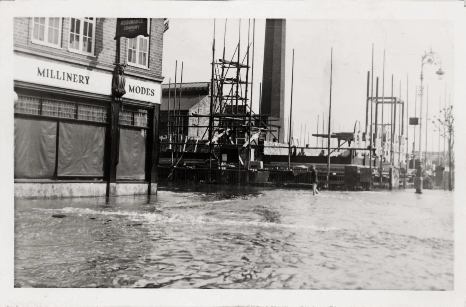
The Town Hall under construction in May 1932 when the River Anker and the Wash Brook flooded. The footings were completely washed away and the build had to be started again, delaying the opening until 1934. Milliner's became The Tool Box and is now closed awaiting redevelopment into a cafe.
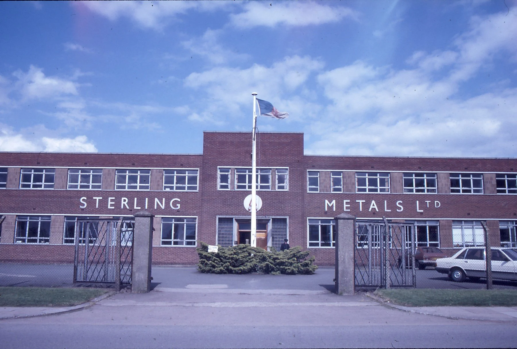
Stirling Metals, part of the Birmid Industries Group. It was the biggest employer in Nuneaton. It closed in 1987, unable to compete with the allegedly subsidised competition from Spain and Brazil.
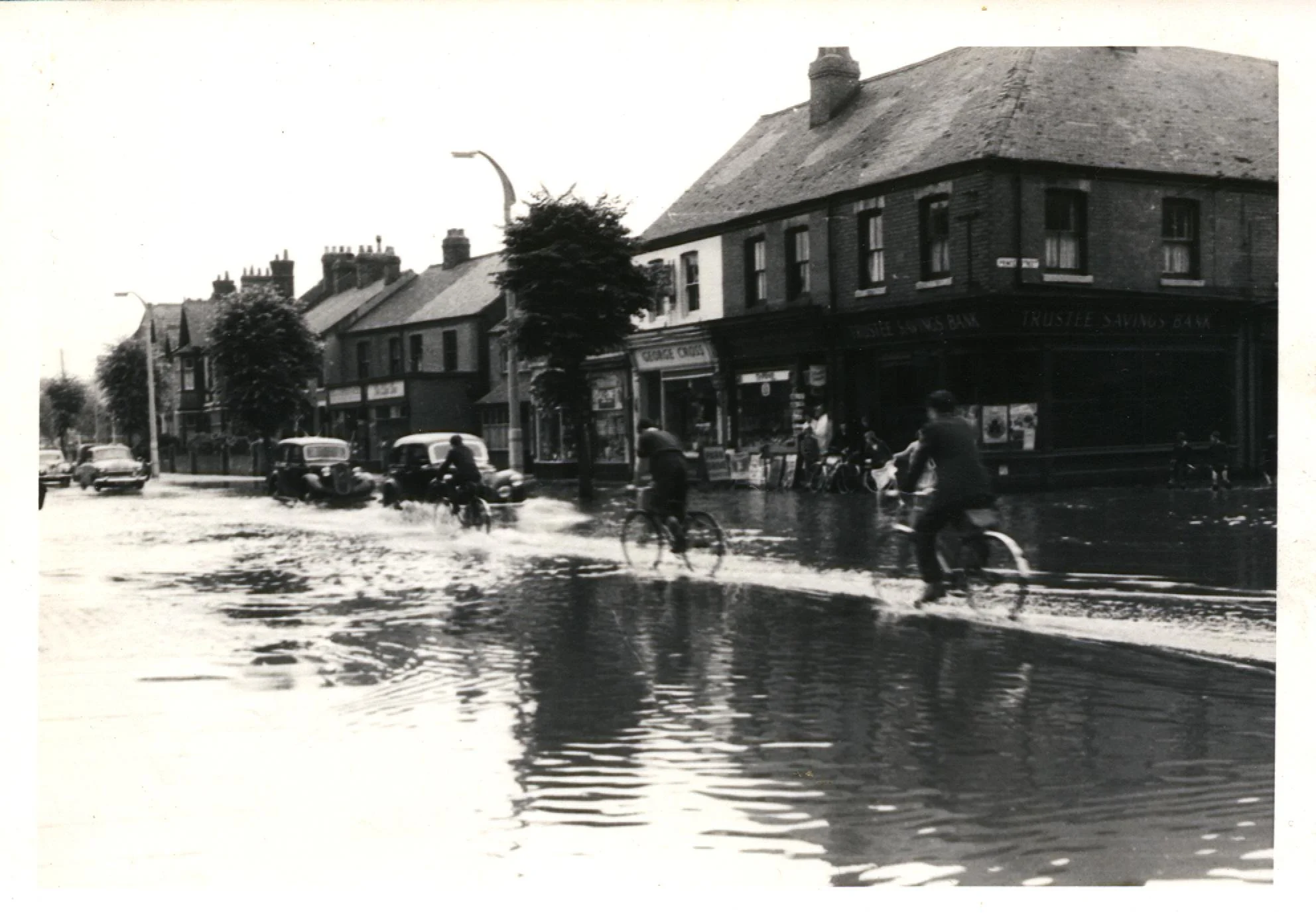
Coton Road. In the distance is the old Mining School on the corner of Riversley Road. The first cyclist is just going past where the Roanne is now. Hiding behind the first tree is the now derelict 'Redroofs', home to Mr L E Price, Mayor of Nuneaton in 1929 and the house later became 'Redroofs' surgery. Floods were common in Nuneaton in the 1950’s.
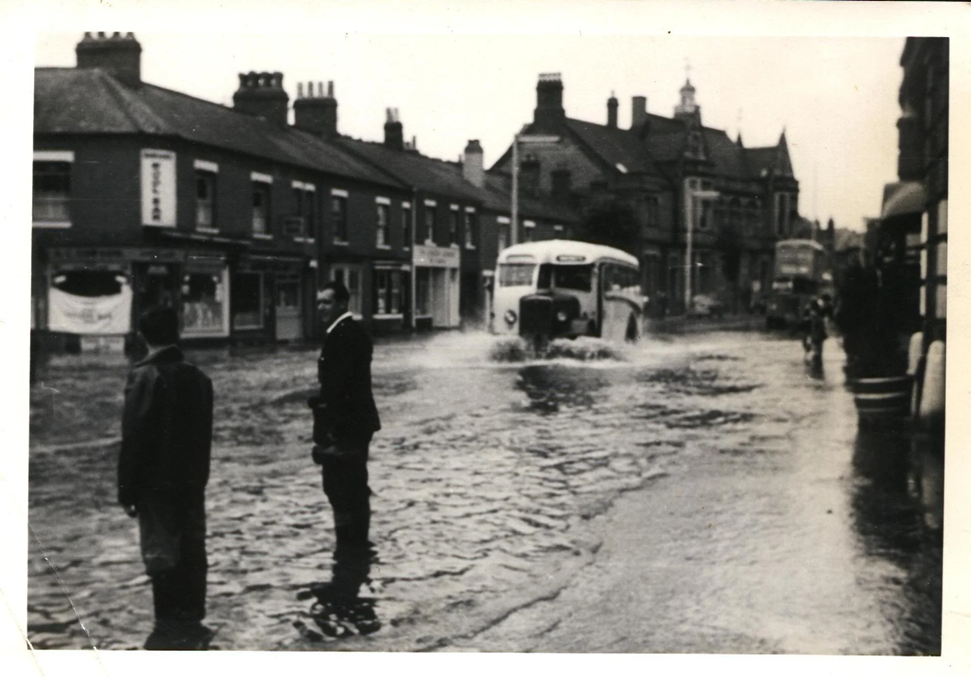
Coventry Street in the 1950's (possibly 1958) showing the flooding which was not uncommon. In the background you can see the old Police Station (now Virgin Bank), next to it is Armstrongs and the first of the small houses is Evolve Hair Stylists. All the other shops and houses have gone to be replaced by the Multi Storey Car park and the Roanne.
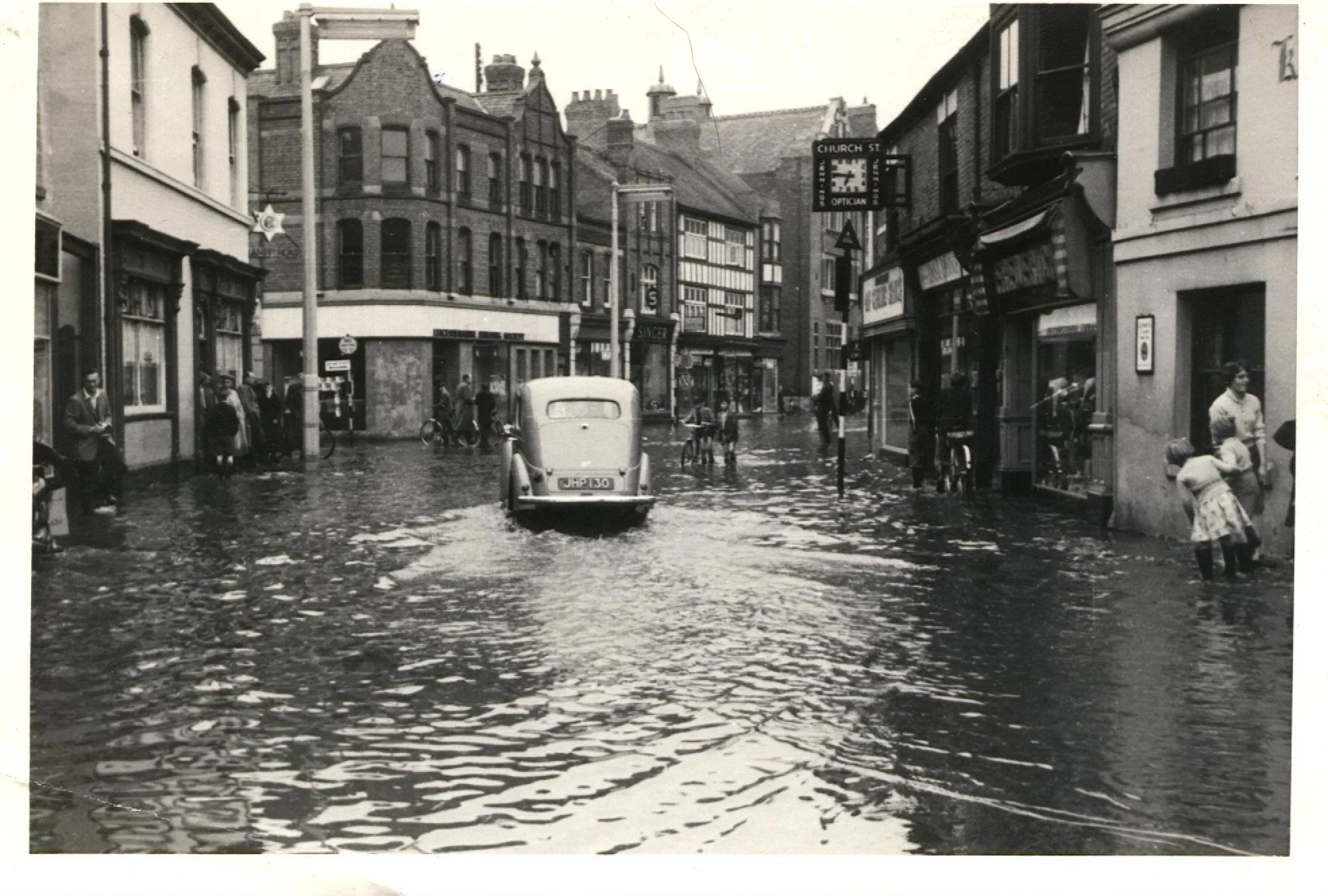
Church Street in the floods. 1950's. The white building on the left is the Saracens Head that stood on the corner of Bridge Street. The car was registered in August 1949 (according to the number plate) so the photo is early 50's. Floods were common right up until the flood relief scheme was installed.
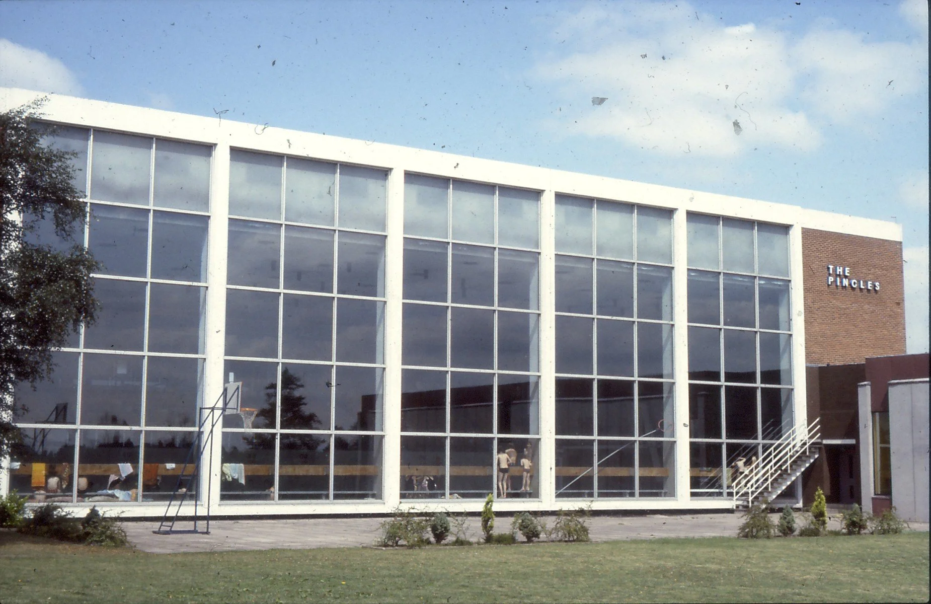
The original Pingles Leisure Centre in the early 1970's. Built in 1965 it closed in 2003 to be redeveloped into the new running track and sports complex whilst the new Pingles Leisure was built on what was the the car park.
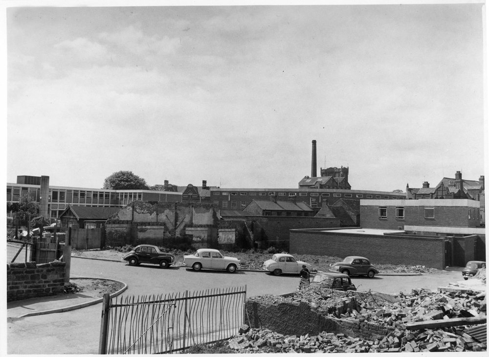
Looking across from Vicarage Street to the redevelopment on Church Street. The untouched Granby Head can be seen on the right.
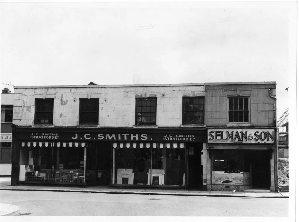
The old J C Smiths furniture awaiting demolition in 1967. The site became Sainsburys supermarket and next to it on the left was Tandys. The Granby Head public house (just in view on the left) was not affected. To the right of the new Sainsbury was the Post Office and next to that the Tax Office.
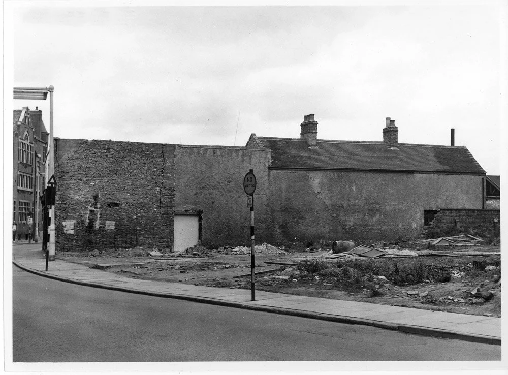
Photo taken from the corner of Wheat Street looking across to St Georges Hall at the Bond Gate/Newdegate Street junction. Warwick House would be eventually built on the cleared land.
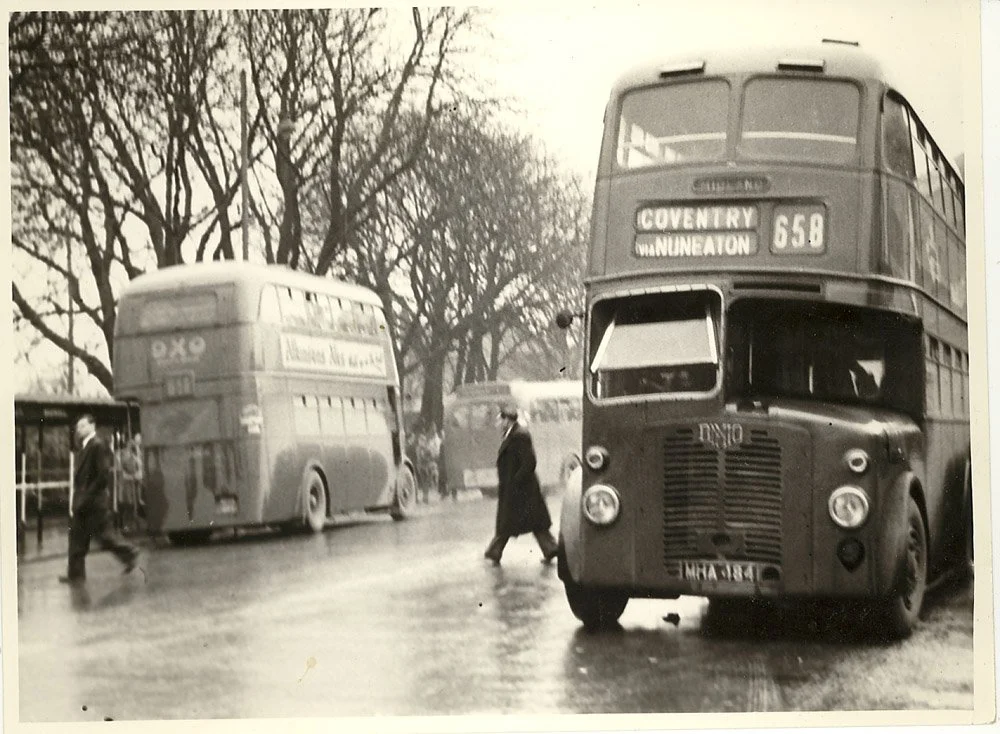
Bond Gate, year not known but probably late 50's early 60's. The 'OXO' bus on the left is parked by the bus shelters alongside the river. The shelters were removed and became a taxi rank.
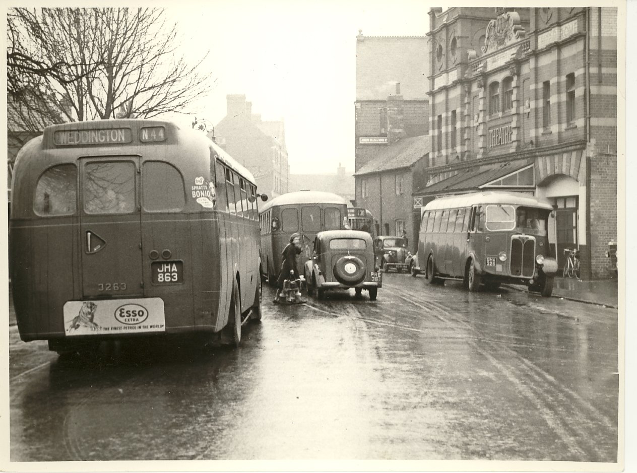
Bond Gate again. The single deck bus on the right is parked outside the old Hippodrome Theatre, now long gone.
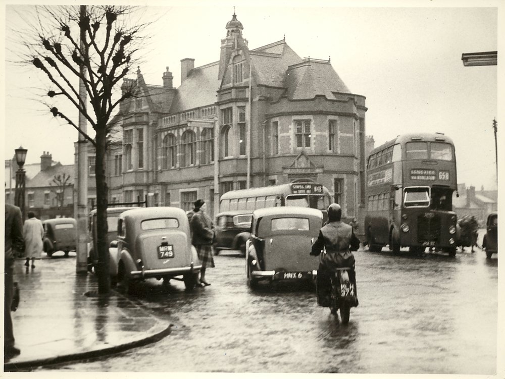
View from the corner of the Town Hall looking across to the Police Station which became the Yorkshire Bank and then Virgin Bank. The tree in the foreground is still there but a lot bigger!
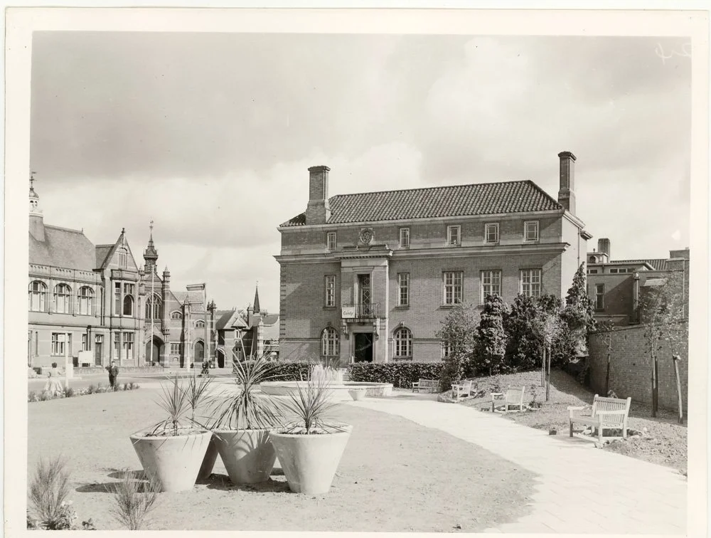
View from the small gardens looking down to the Town Hall. At the bottom of the gardens you can see the fountain. With its benches and art deco flower tubs it was a peaceful spot and very popular at lunchtimes in the summer. It was destroyed to build the new Council House, which in 2020 became a council run HMO for the homeless.
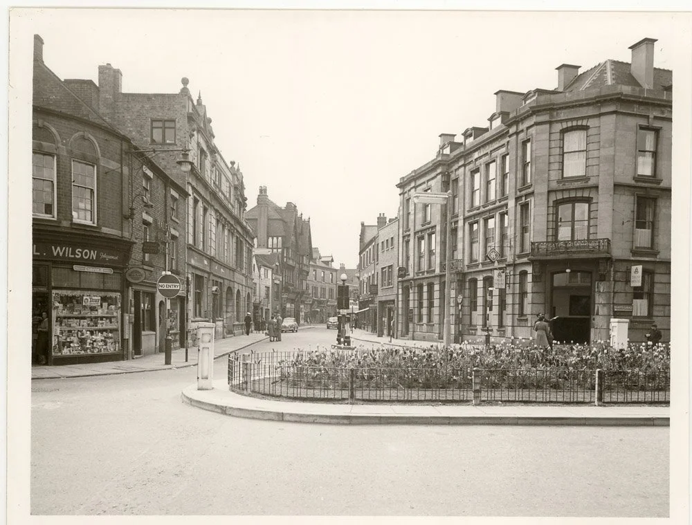
The view from outside J C Smiths looking across to the Newdegate Arms Hotel on the corner of what is now the Harefield Road/ Newdegate Street junction. The hotel was demolished in the 1960's clearances and the Heron Arcade built on the site. The Heron later became the Abbeygate Shopping Centre.
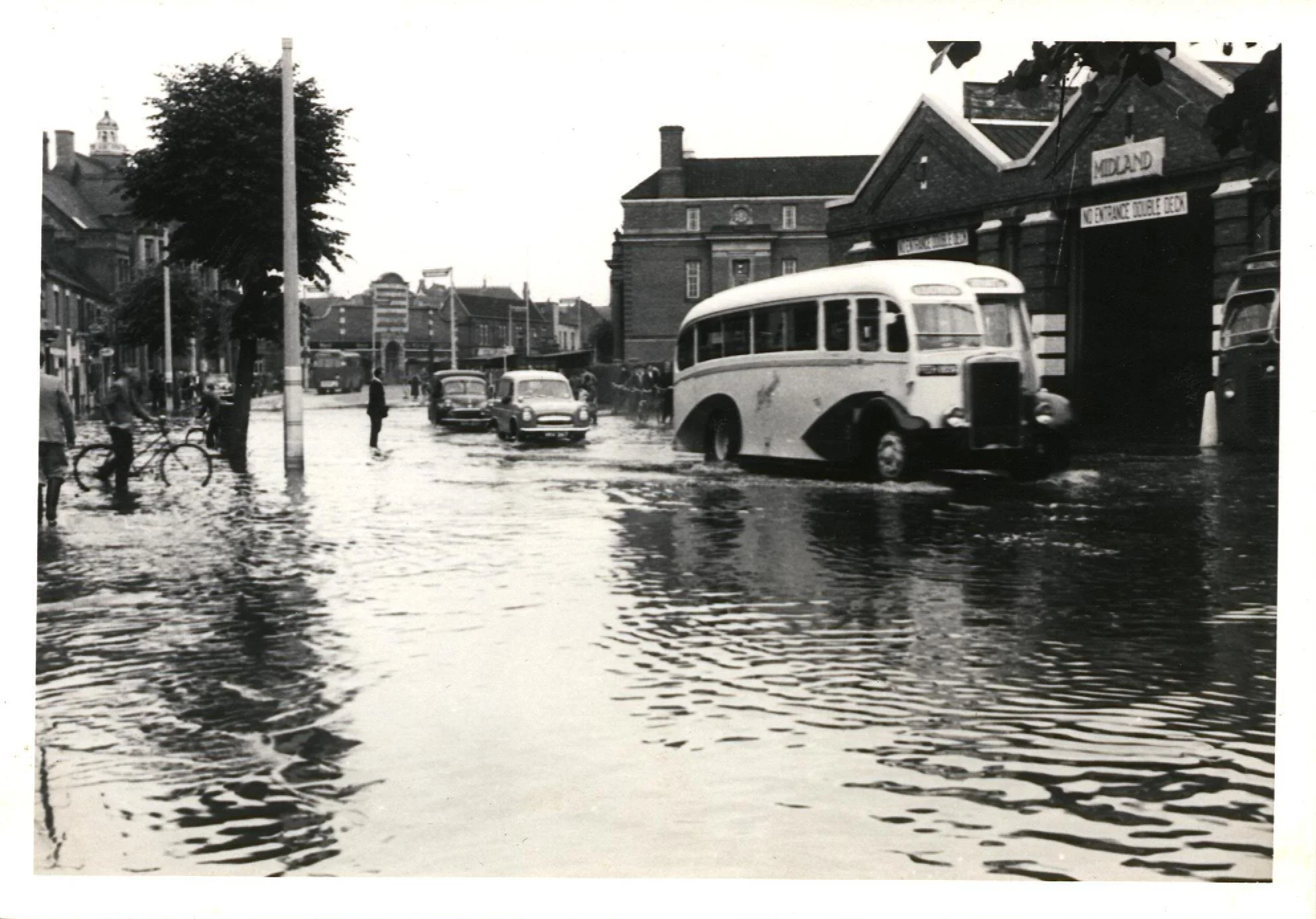
The Bus Garage in Coton Road, just up from the Town Hall. At the back of the garage was the Nuneaton Electric Light Company. When the garage was pulled down in the mid 60's it was replaced by the open space seating area and fountain.
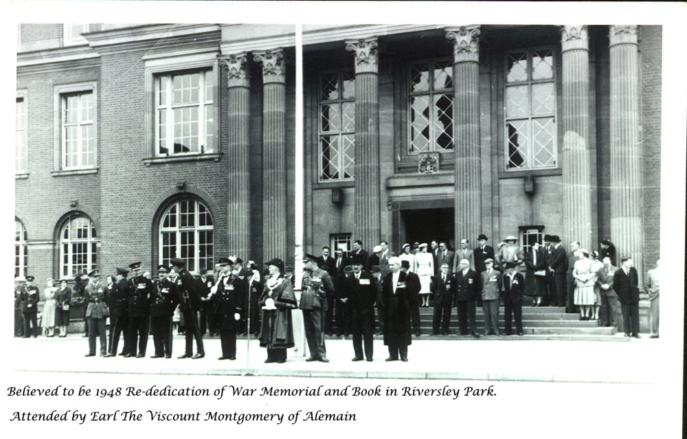
Believed to be the 1948 visit of Field Marshal Viscount Montgomery to Nuneaton to attend the re-dedication of the War Memorial in Riversley Park. The photo is looking at the exterior of the Town Hall where the civic party is awaiting Montgomery's arrival. The Mayor is Alderman G. Comley.
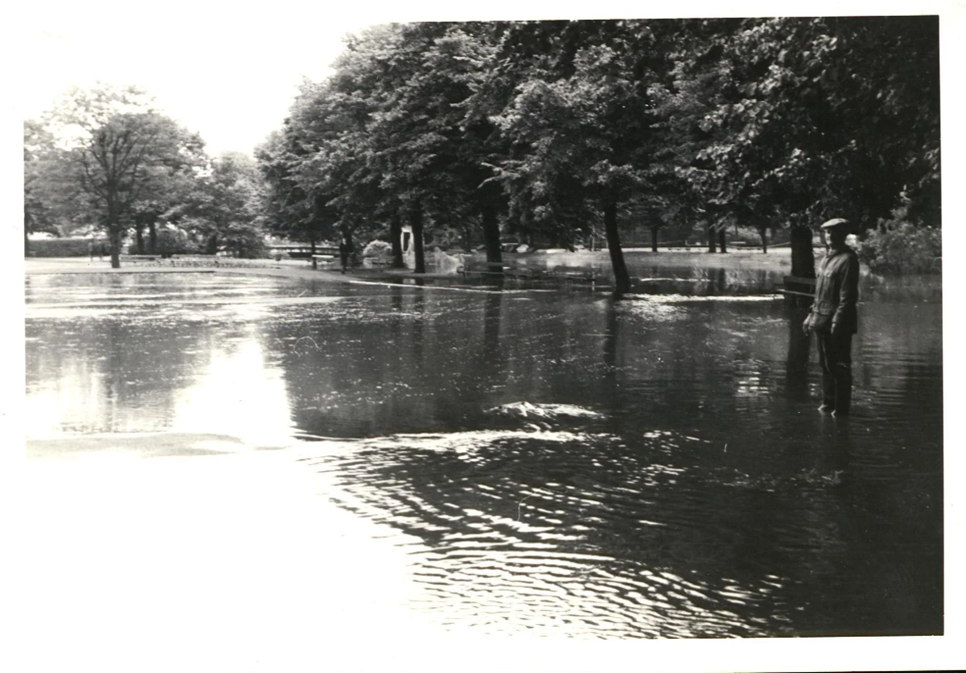
Riversley Park in (we believe) 1958 floods. Way in the background you can see the old bridge that connected the park to Lovers' Lane that ran at the back of Union Wool and Leather (now Sainsburys). Before the flood relief scheme was implemented, the park was prone to severe flooding.
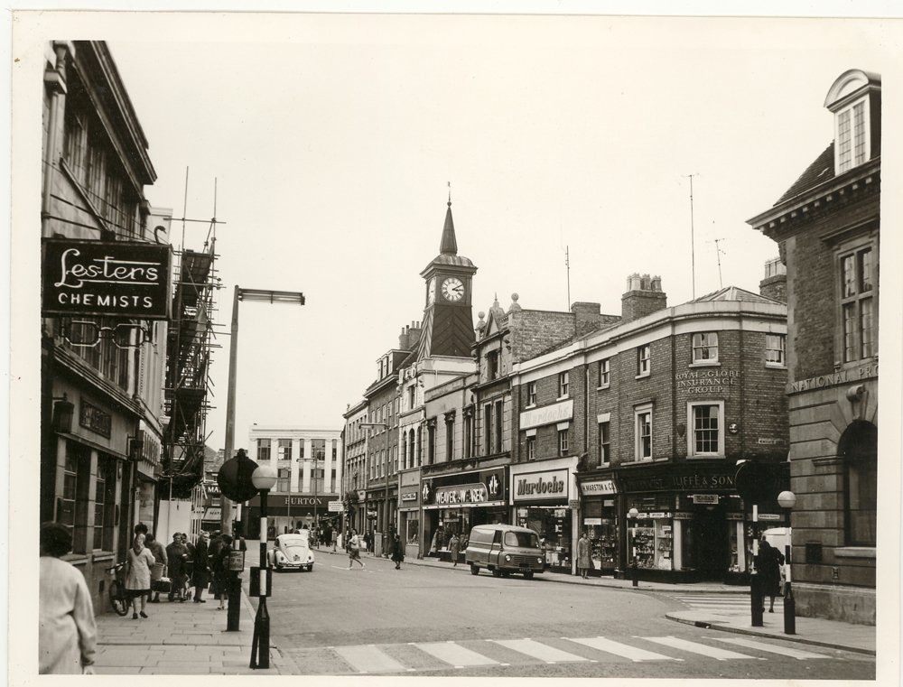
Nuneaton in 1962. Although the shops have changed, the buildings are virtually the same. Weaver to Wearer is now Vodaphone, Iliffes was O2 (now empty), Burtons at the bottom of Market Place is Clintons, Lesters Chemists is Boots. Pedestrianisation was far into the future.
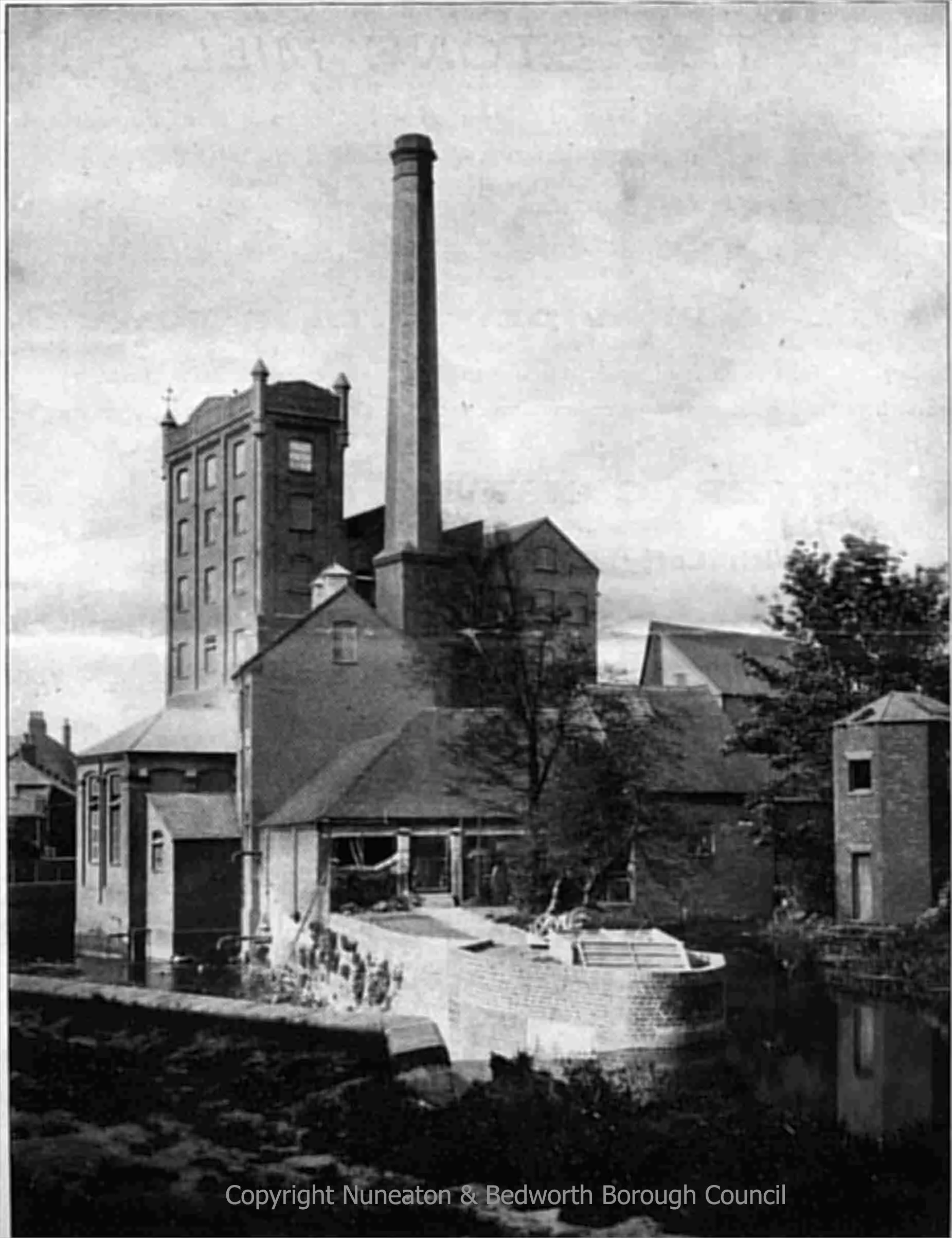
Nuneaton Flour Mill. The photo was taken by the agents for the sale of the mill in 1903. The mill was sold and continued to work until the late 60's. It was demolished in 1973 and the DSS building replaced it.
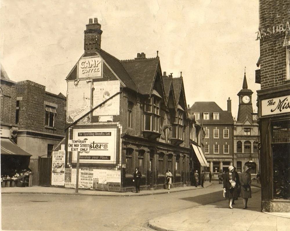
In the centre of the picture is the original Nag's Head public house. You can see the 'nag's head' just above the lady in the white coat. The photo was taken circa 1920. At the bottom of Coventry Street is the Westminster Bank. The white blinds are Woolworths original site. On the corner of Mill Walk is 'Millinery Modes' ladies fashion shop, became 'The Toolbox' and is now being redeveloped. The grocers on the left is now an empty shop (was an estate agents?) and next to that (not on photo) is Masons.
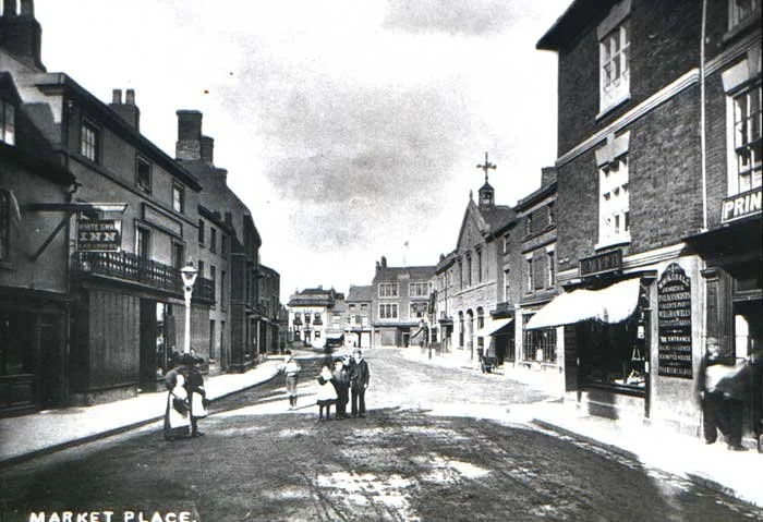
This photo is late 1800's. The clock tower has not yet been built, though the 'streetscape' of Bridge Street, Market Place and the corner of Wash Lane (Queens Road) are instantly recognisable.
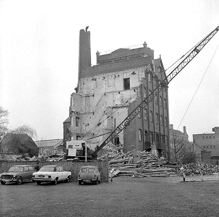
“Reproduced from the “Our Warwickshire” website ©. The photo shows the demolition of the flour mill in 1973. In the background you can see the side profile of the Town Hall and the George Eliot Building.
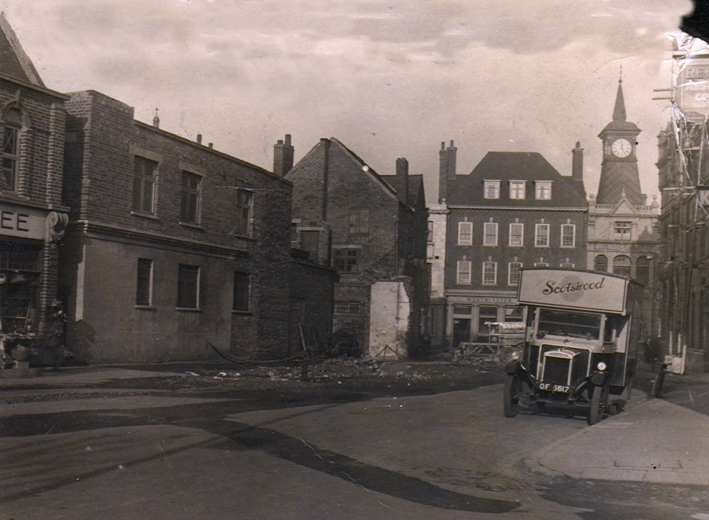
The same view a decade or more later. It was decided to widen Coventry Street and of course the 'Nags' and Woolies had to go. You can recognise the 'streetscape'; by the white wall there is now a telephone box. If you look carefully at the 1920 photo (above) you can see the top windows of a building behind the pub. In this photo - the whole of the pub and Woolies has gone and the windows are clearly visible. It does indicate just how narrow Coventry Street originally was. The number plate for the lorry in the photo was registered in 1932 in Radnorshire, now part of Powys in Wales.
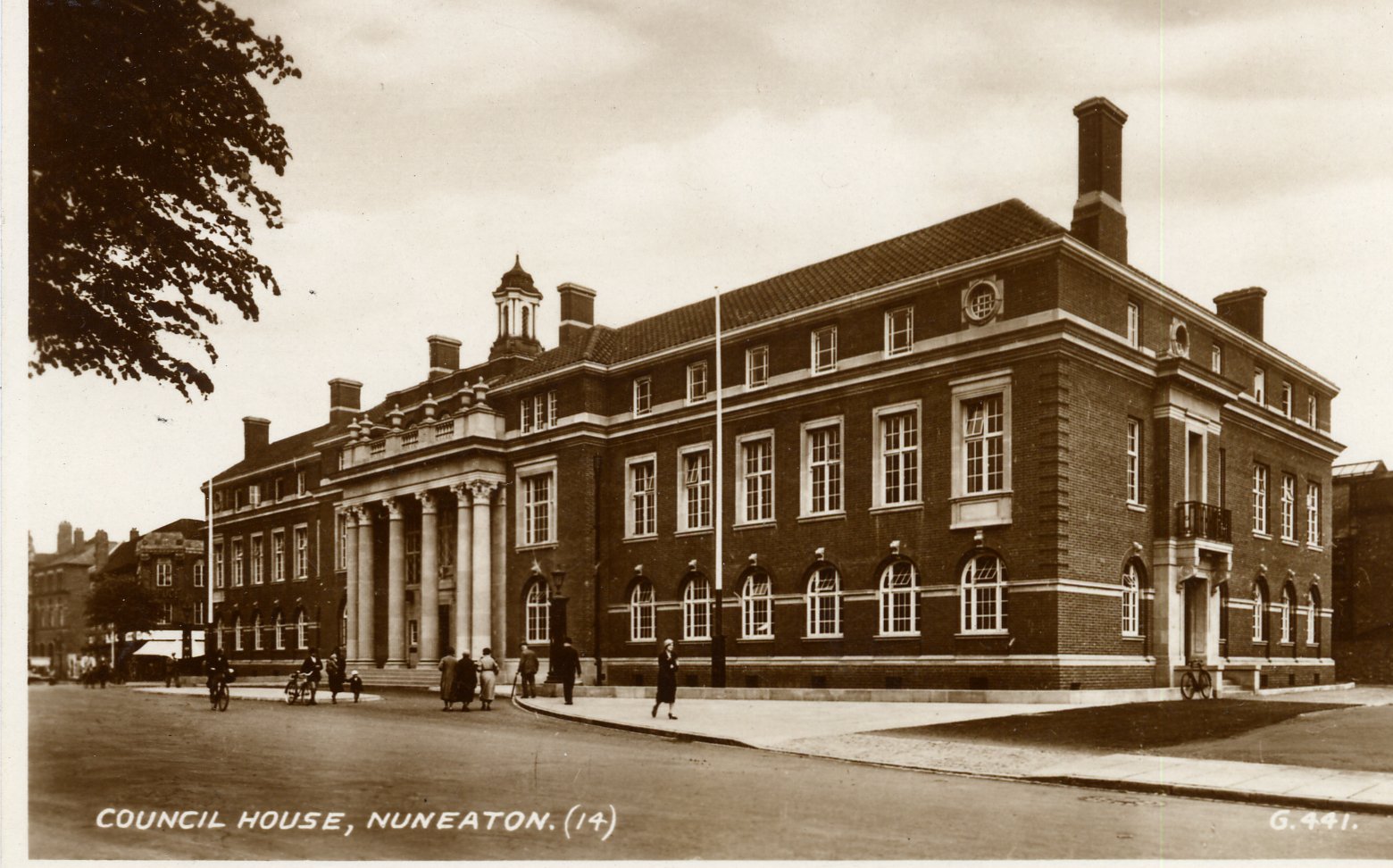
The Town Hall, originally called the Council House. The postcard is 1950's and shows quite clearly the original 'footprint' of the town hall before the in-fill that removed the small layby (for use only by the Mayor and visiting dignitaries). Note the two flagpoles, now replaced by a single short flagpole on the central balcony and no disability access ramps. The top floor was accommodation for the Chauffeur and the Sergeant at Arms who lived on the premises.
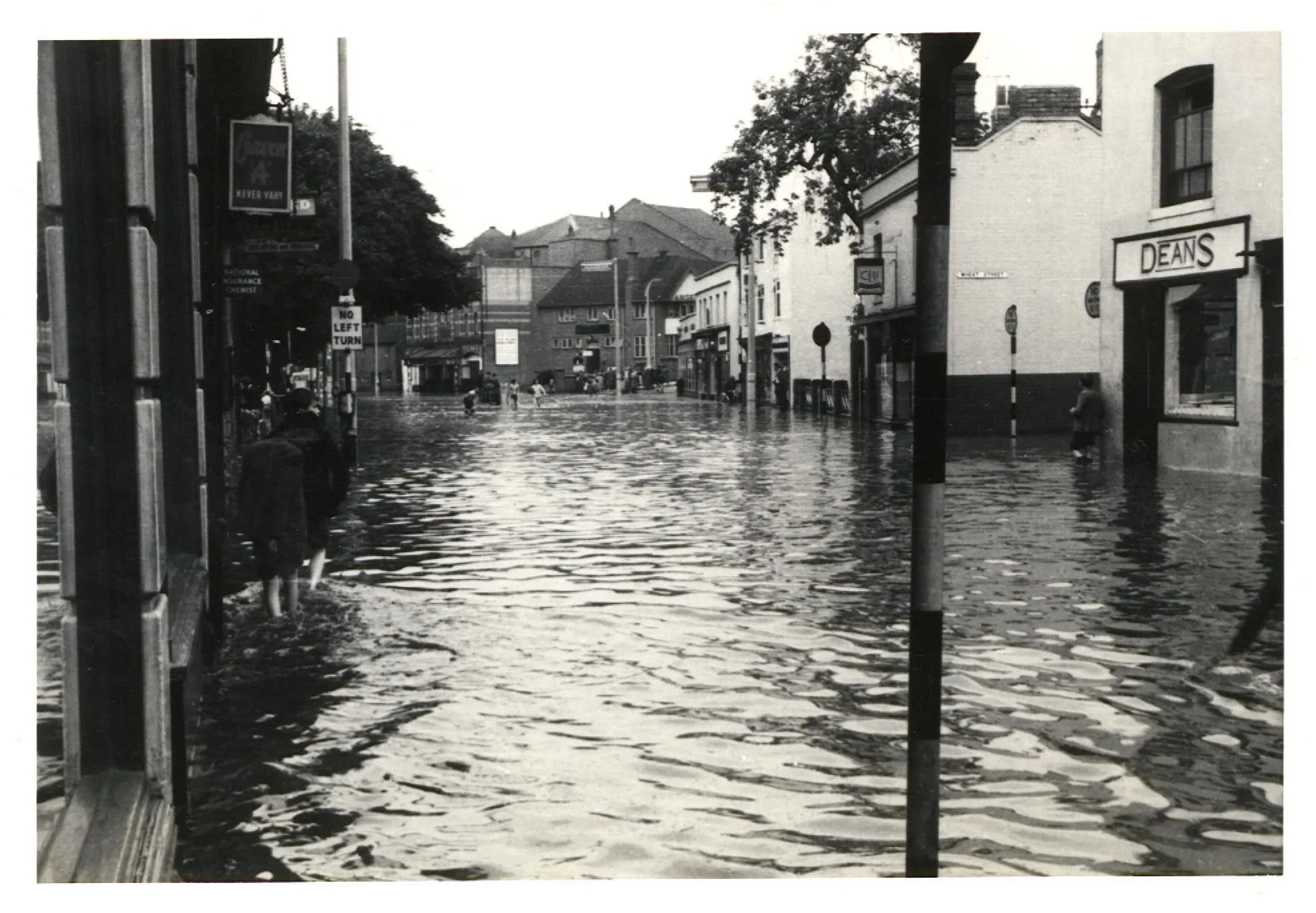
Another flood photo. This is Church Street looking towards Leicester Road. Next to Deans is Wheat Street, which is now the exit for traffic using Justice Walk and at the centre of the photo is the old Hippodrome Theatre. The Hippodrome was demolished on the 14th September 1968 after two fires had made it unsalvageable. Deans is now the The Black Swan in Hand. The white walled building on the other corner of Wheat Street/Justice Walk and the other two buildings next to it have been demolished and FED EX now stands there.
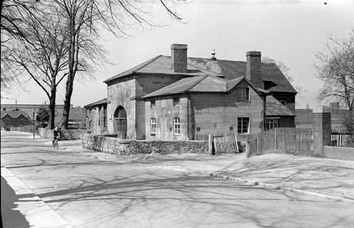
The Heritage Centre as it was just after the Second World War when it was still a school. If you look at the roof you can see the repairs from the damage received when Coton Church was hit by bombs on the night of 17th May 1941.
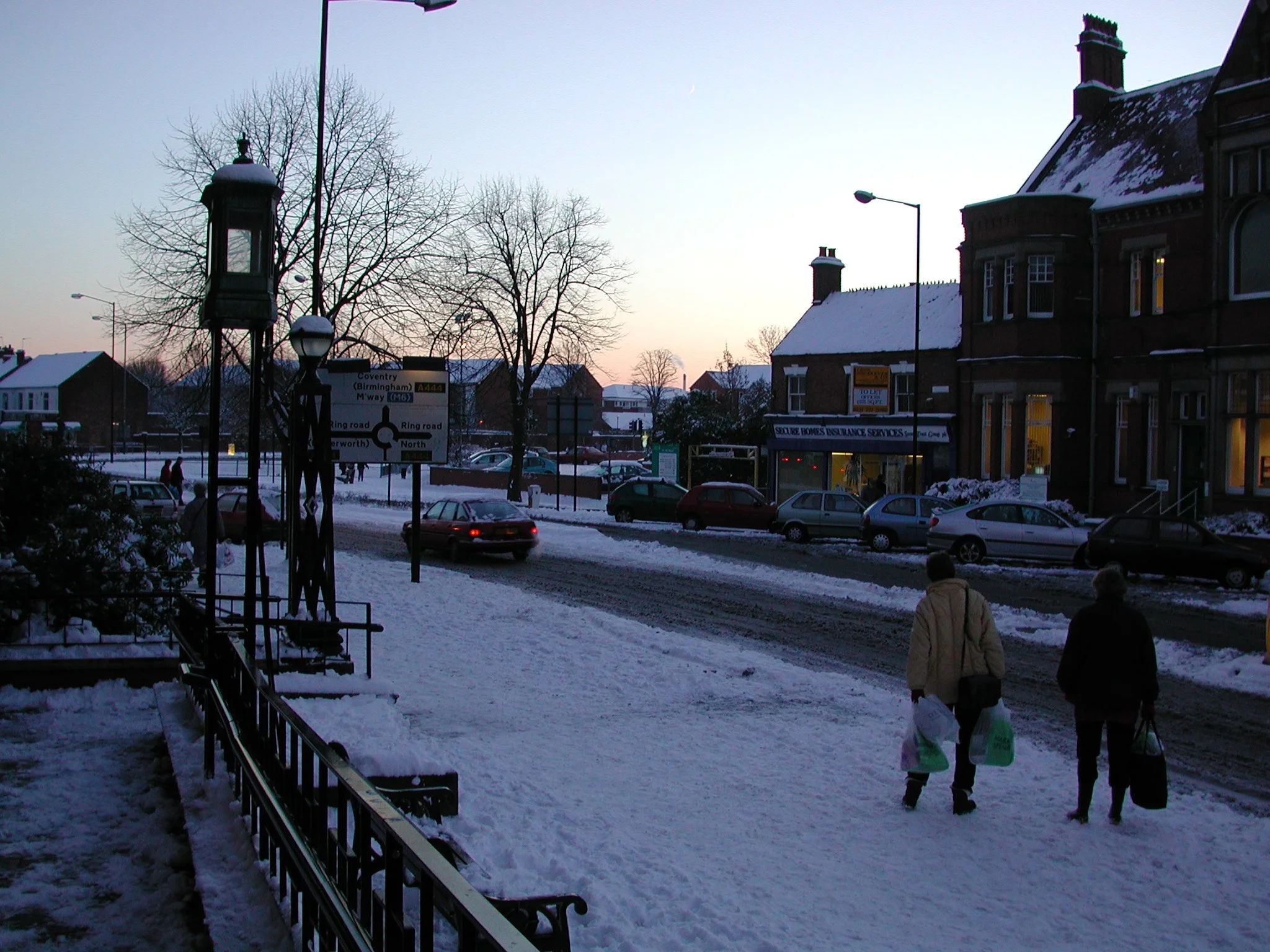
Taken from outside the Town Hall in the winter of 2000, the streets seen without the Rope Walk car park and the remodelling of the walkways alongside the Roanne.
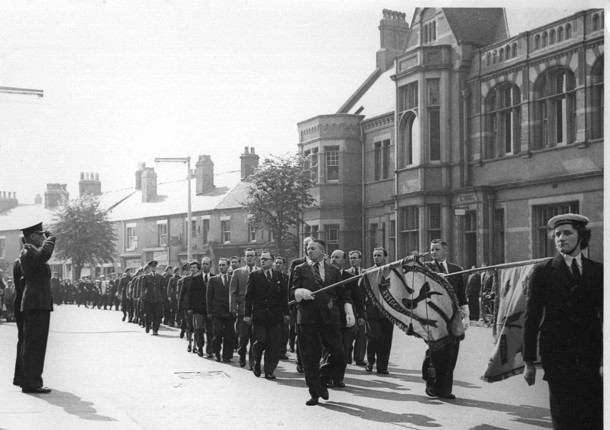
Battle of Britain Parade passes the front of the Town Hall in 1958.
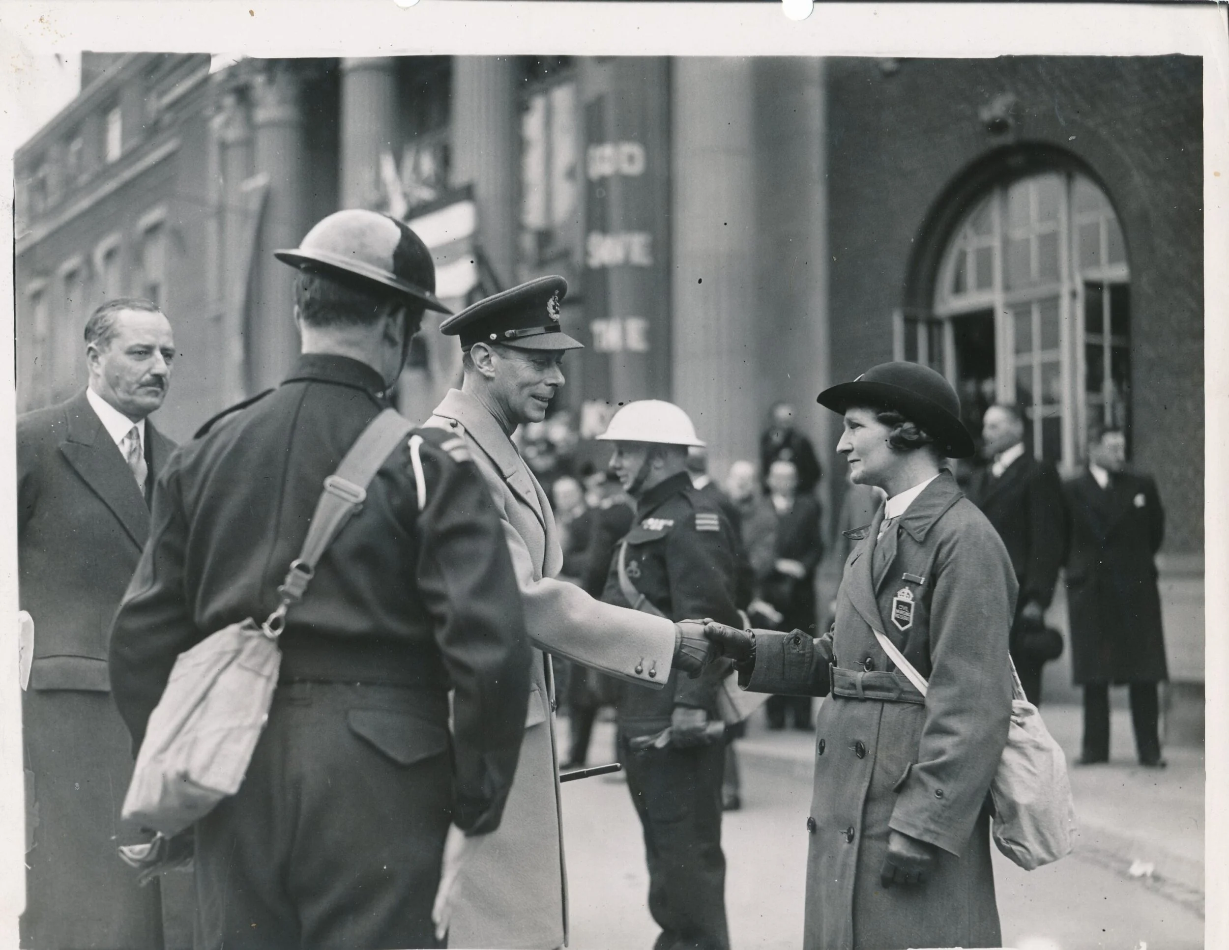
King George Vl and Queen Elizabeth (Elizabeth Bowes-Lyons) visited Nuneaton in 1943 to meet with and to present medals to the volunteers of the Womens Voluntary Services, the Blue Light Services and the Civil Defence who did so much during the bombings of 1942.
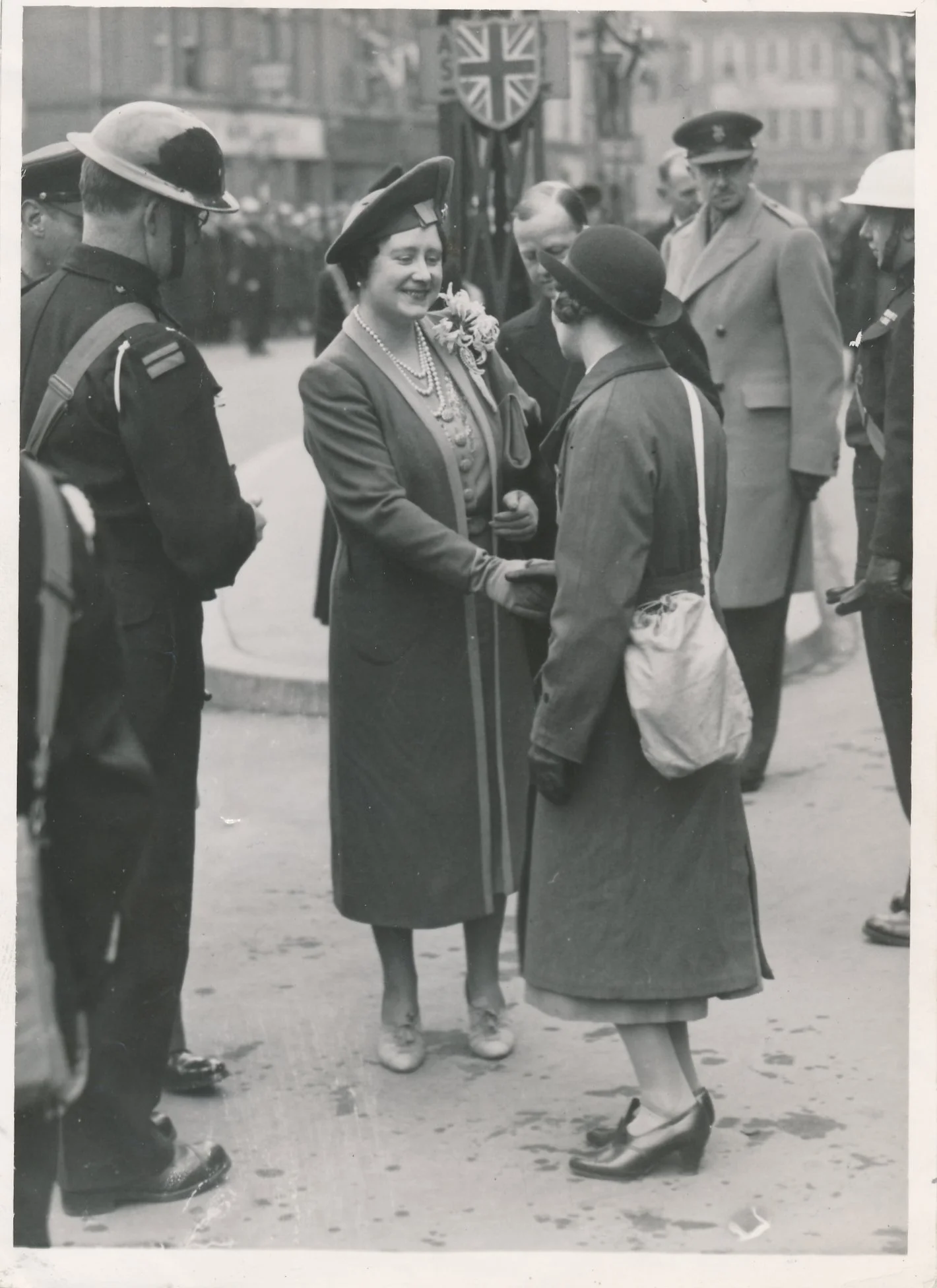
King George VI visit.
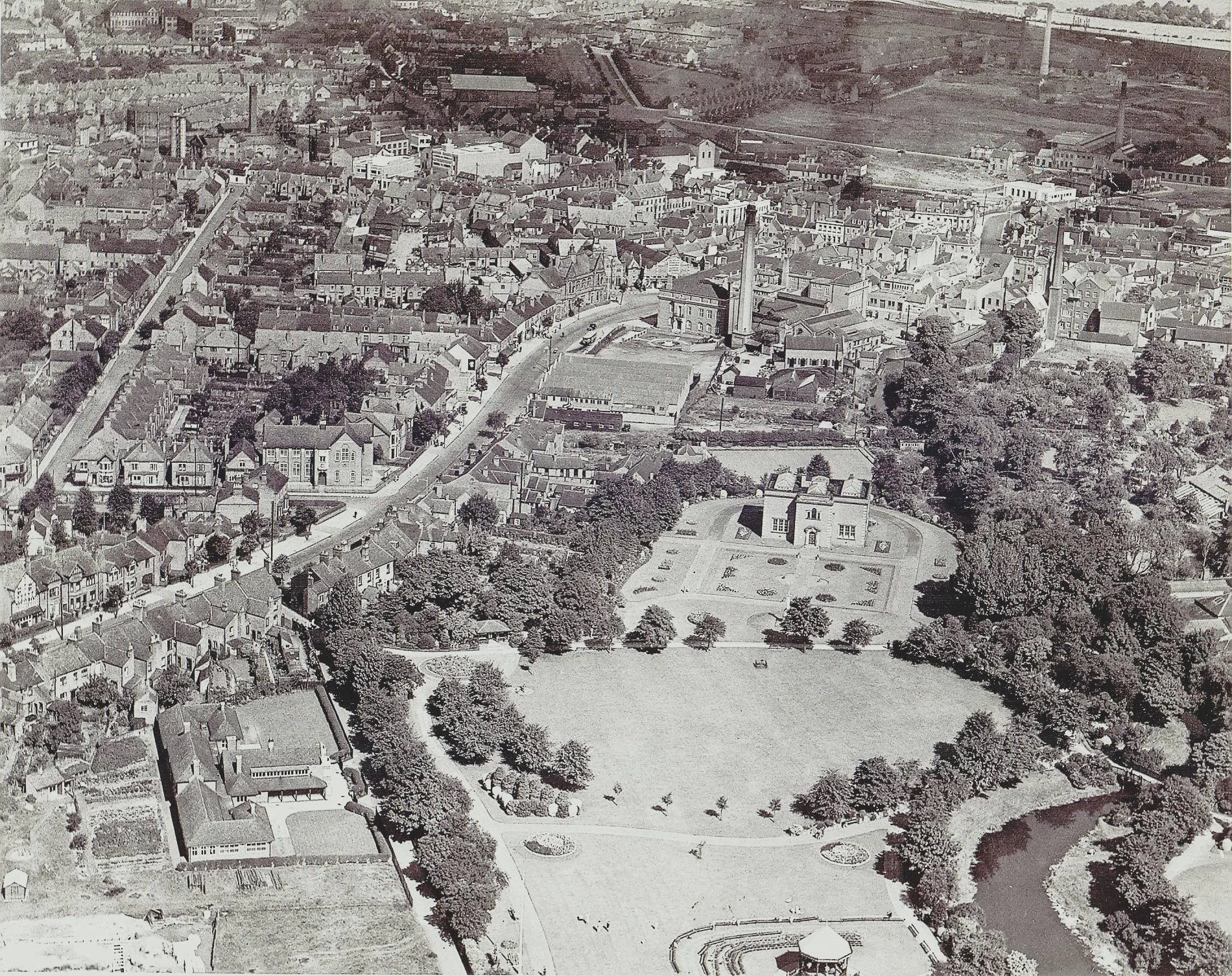
Old aerial photo of Nuneaton. Bottom right is the bandstand in Riversley Park; centre right is the Museum, far right edge you can make out the buildings of the Union Wool and Leather. Behind the Museum is the Town Hall with the Electricity Board chimney. The houses along Coton Road on the park side were demolished to widen the A444. If you look very carefully you will see the bandstand has a band playing and people seated around the perimeter. It's a fairly safe bet this photo was taken on a summer Sunday. It's hard to estimate the date but we think 1930’s.
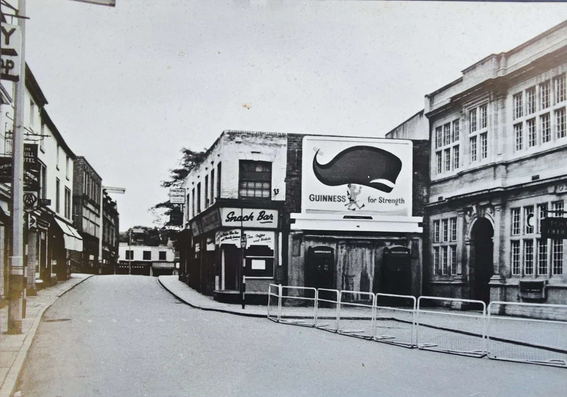
Bridge Street before it was widened in 1959. The old Post Office is on the right hand side and on the corner stands the Snack Bar, haunt of the Teds through the late 50’s.
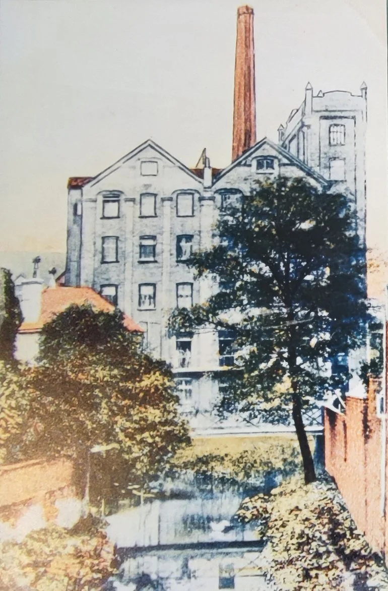
The Nuneaton Roller Mill (Nuneaton Flour Mills) seen from the Bridge Street Bridge before the shops were built, if you stand on the bridge looking towards Church Street and turn to your right, this is the view you would have seen at the beginning of the 1900’s.
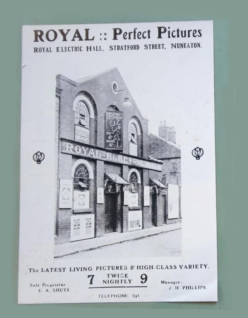
The Royal Electric Hall (a.k.a. The Royal Picture House) which stood in Stratford Street. It was opened in 1910 on the August Bank Holiday and closed in 1939 having been taken over by the War Ministry. It never reopened and was demolished in the 1980’s.
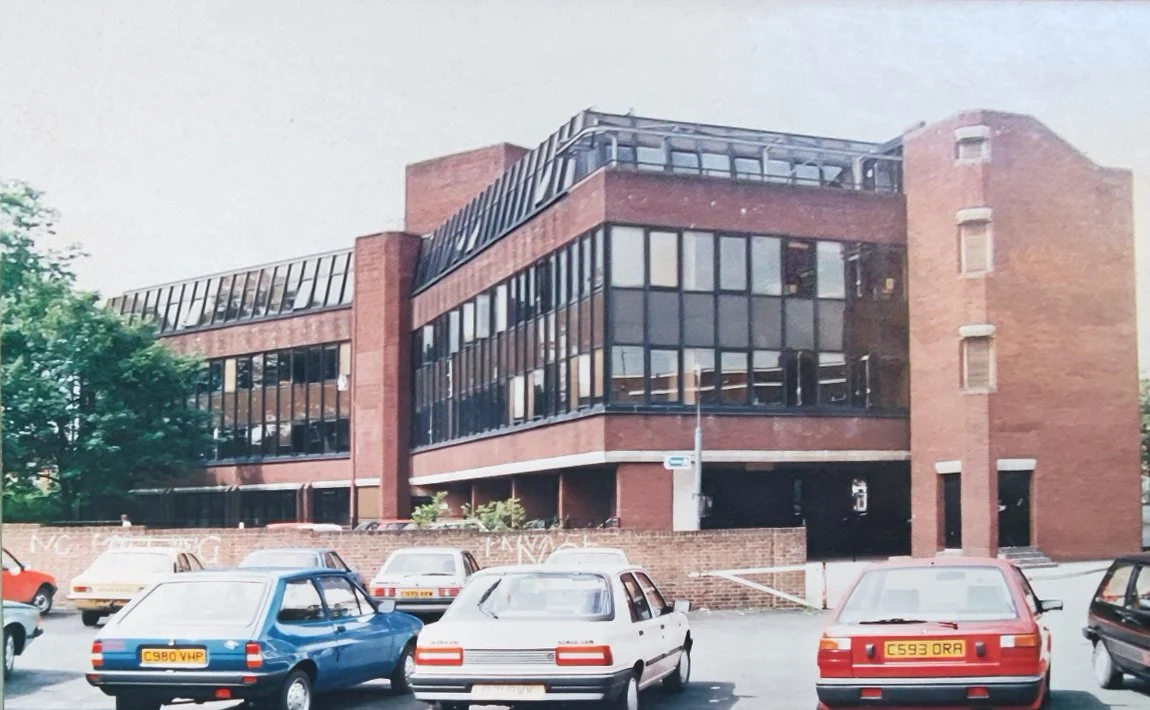
The Job Centre which stood on the site of the old Roller Mills (Nuneaton Flour Mill) which was pulled down in 1973. The now empty Job Centre is to be pulled down under the 'Transforming Nuneaton' project.
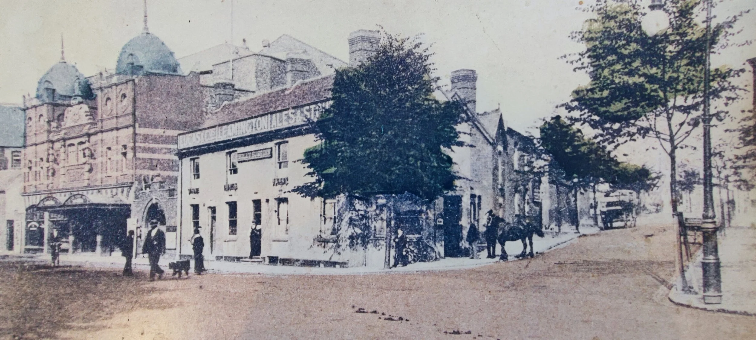
An old postcard from the early 1900's showing Bond Gate/ Leicester Street junction. The Holly Bush pub (purveyor of Leamington Ales according to the sign) is on the centre corner and next to it the Hippodrome Theatre with its distinctive domes. The horse and cart stands on the corner of Back Street. The Holly Bush, the Hippodrome and the buildings behind it will in the future be demolished and replaced by Holly Bush House and retail premises.
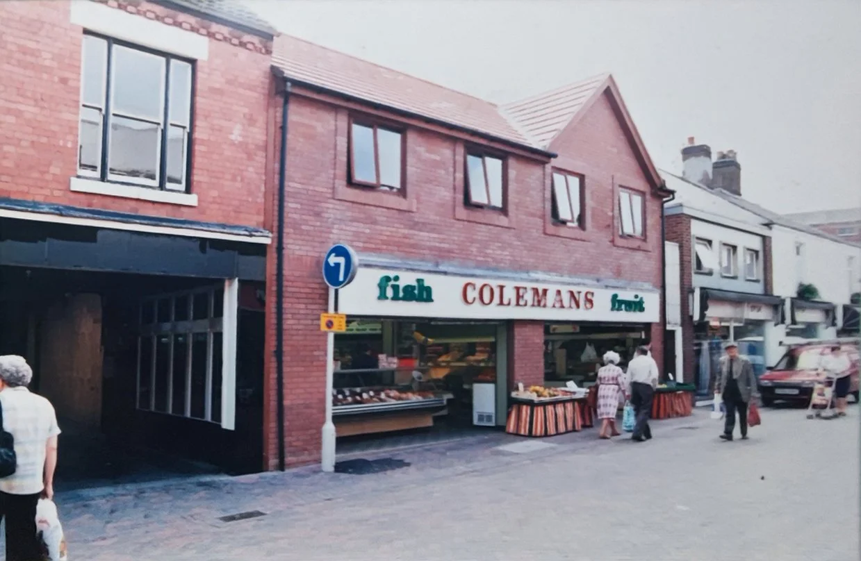
Stratford Street after the demolition of the Royal Picture House. To the left is the garage of Smiths Undertakers, next to it is Colemans Fish and Fruit, a long established local business. The 'Fruit' section of Colemans used to be 'Scoop and Save', but when that closed Coleman's took over the premises.
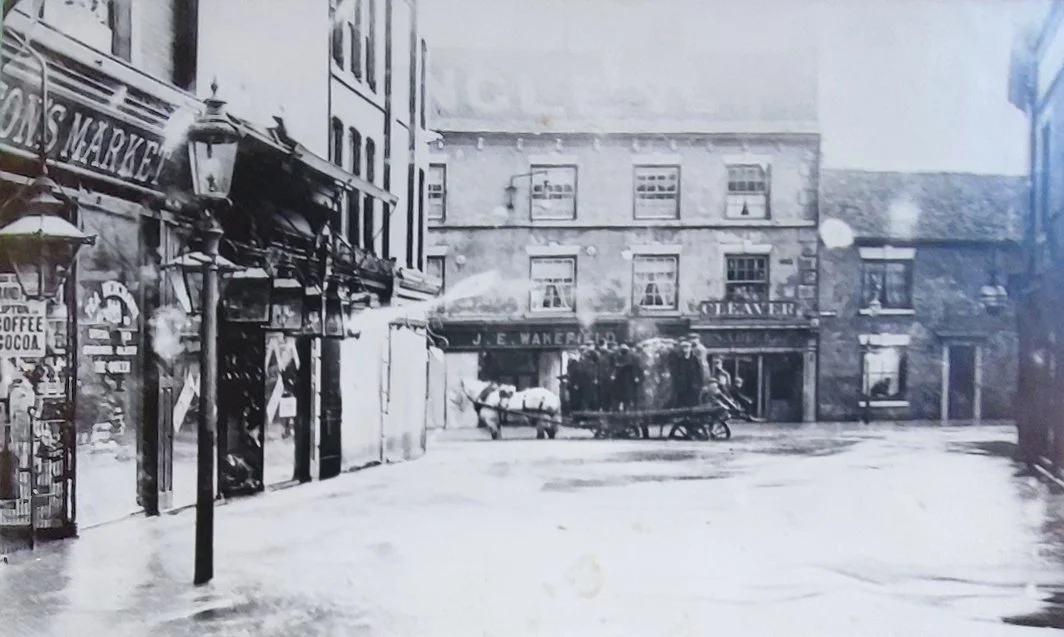
Bridge Street in the 1932 floods. J C Smiths is yet to be built. Bridge Street has not yet been widened. The buildings at the bottom will become J C Smiths furniture warehouse and after being demolished will then become Sainsburys and then Wilkinsons (who will sadly close in 2023).
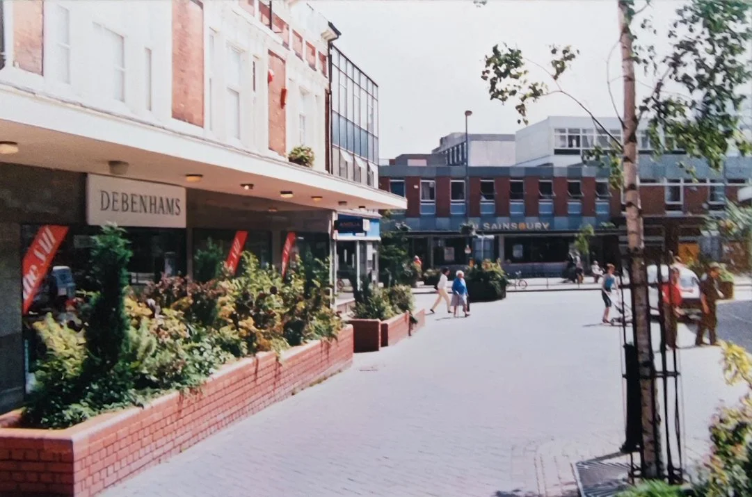
The same view in 1974. Debenhams now occupies the left side frontage, and next to Debenhams is the Anglia Building Society (you can recognise the windows from the 1932 photo). J C Smiths Furniture has been demolished and Sainsbury's supermarket now occupies the site. Next to Sainsbury is the Post Office and to Sainsbury's left facing is Tandys, then the Granby Head P.H.
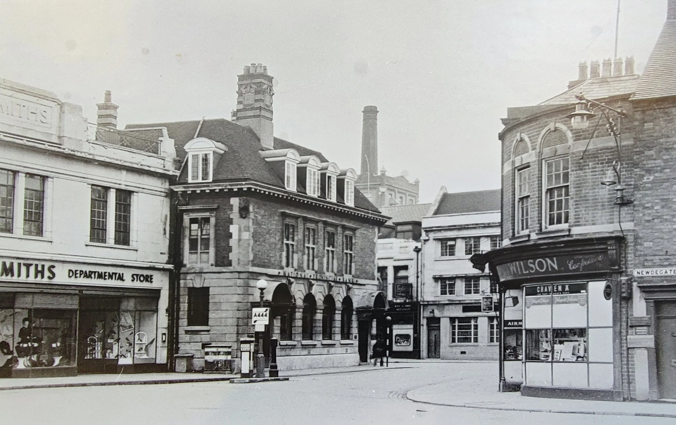
J C Smiths in Newdegate Square sometime in the late 50's or early 60's. In the background you can see the Nuneaton Flour Mill and its chimney. Next to Smiths is the National Provincial Bank, later to become the Bradford and Bingley Building Society. Just visible behind the National Provincial on the opposite side of Bridge Street is Lesters Chemist.
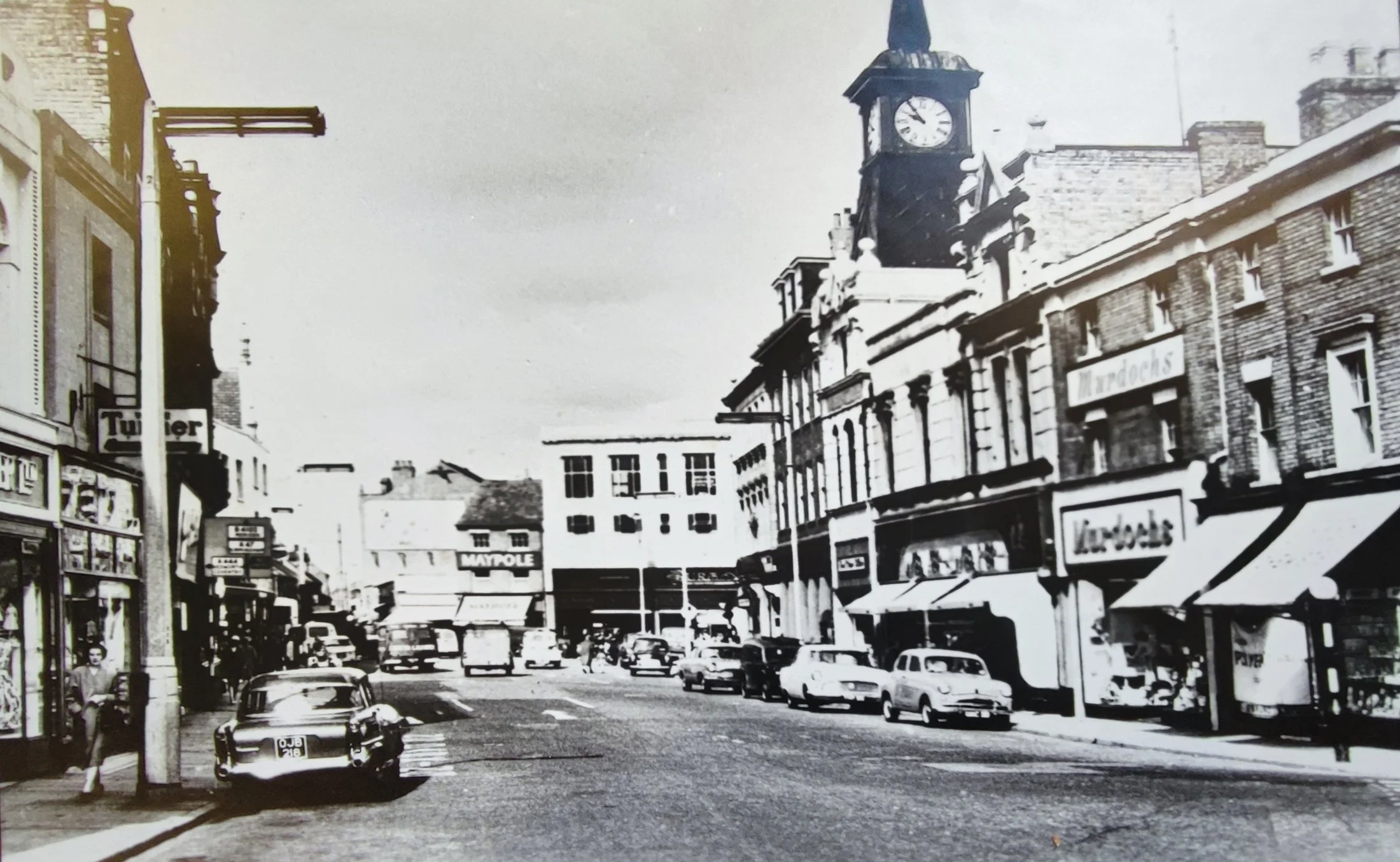
Market Place in the 1960's. At the bottom of Market Place can be seen Burtons and the Maypole. It's only 10.00am but the town is busy, lots of cars parked up. No traffic wardens back then.
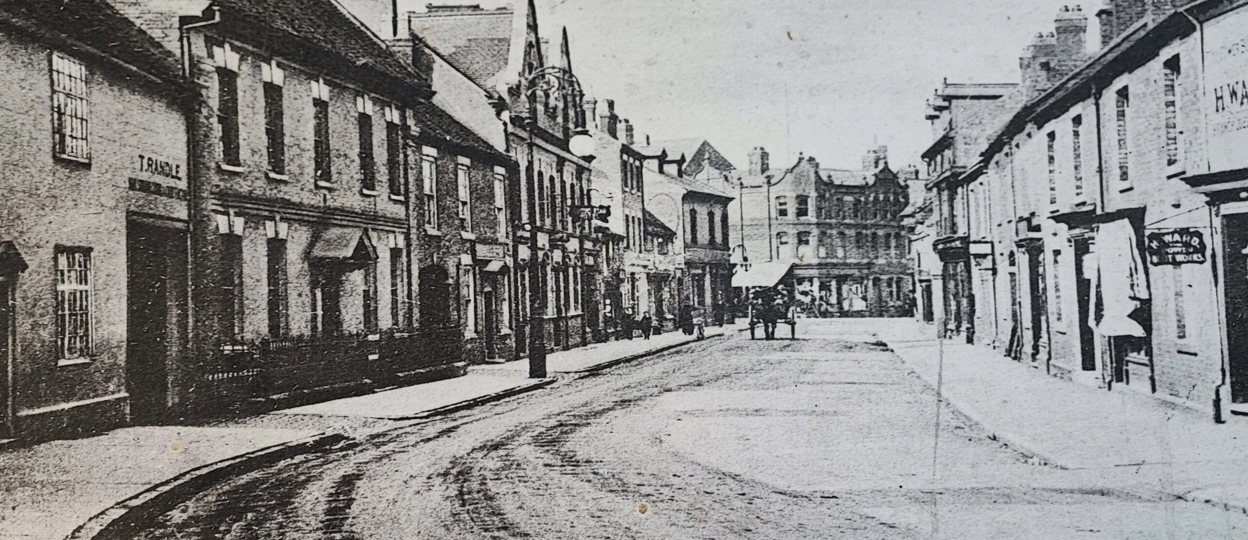
An old photo of Church Street Nuneaton. Probably taken late 1800's or early in the 20th century. Bridge Street is at the bottom off the picture. The building with the two pointed gables is the old Pen and Wig. The house next to Randles in the left foreground is the home of Edward Melley JP who donated the park and museum to the Town in 1907. Melley's house was bombed during WW2 and Melley was killed.
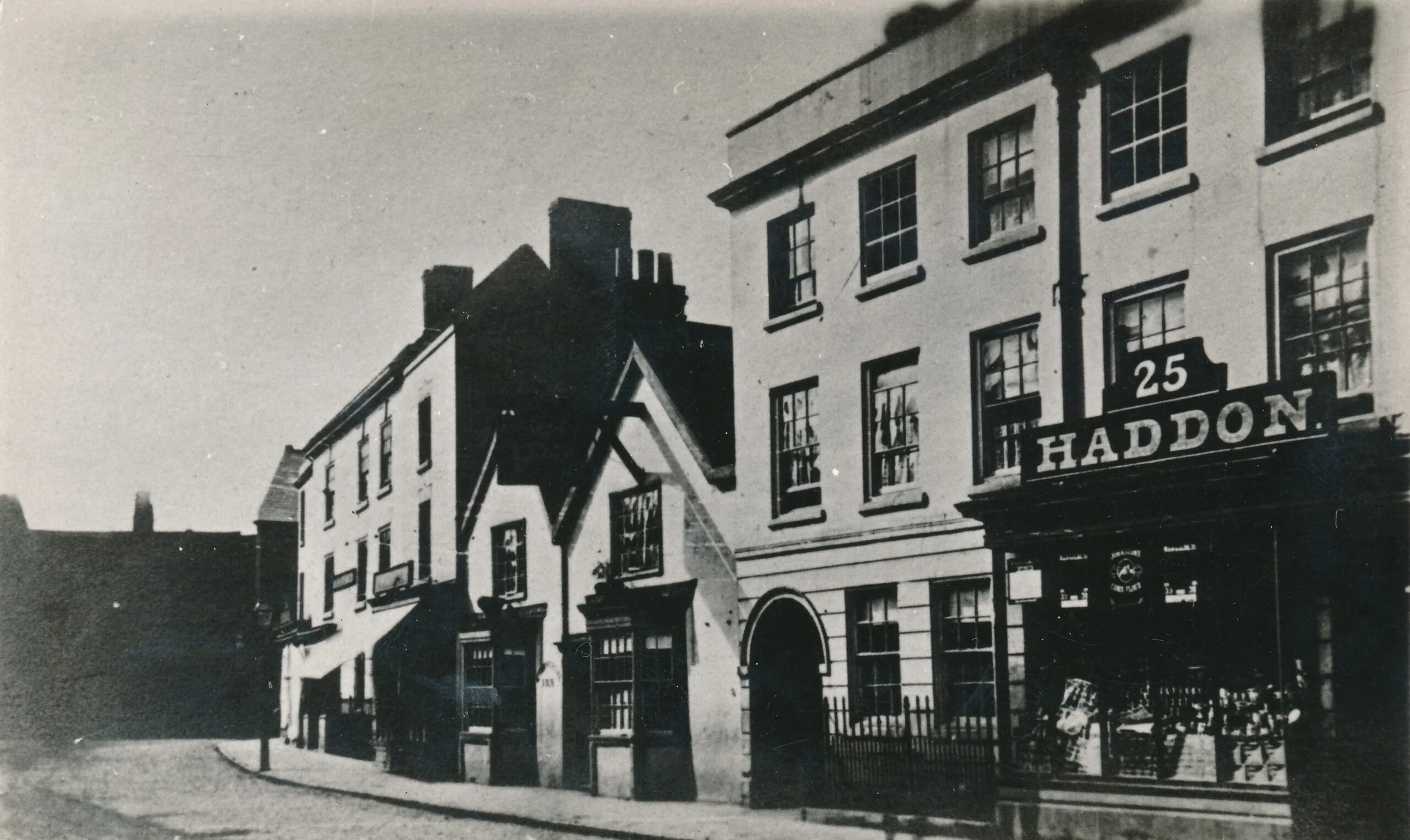
Nuneaton Market Place in 1910 looking down Market Place to where Clinton Cards is now.
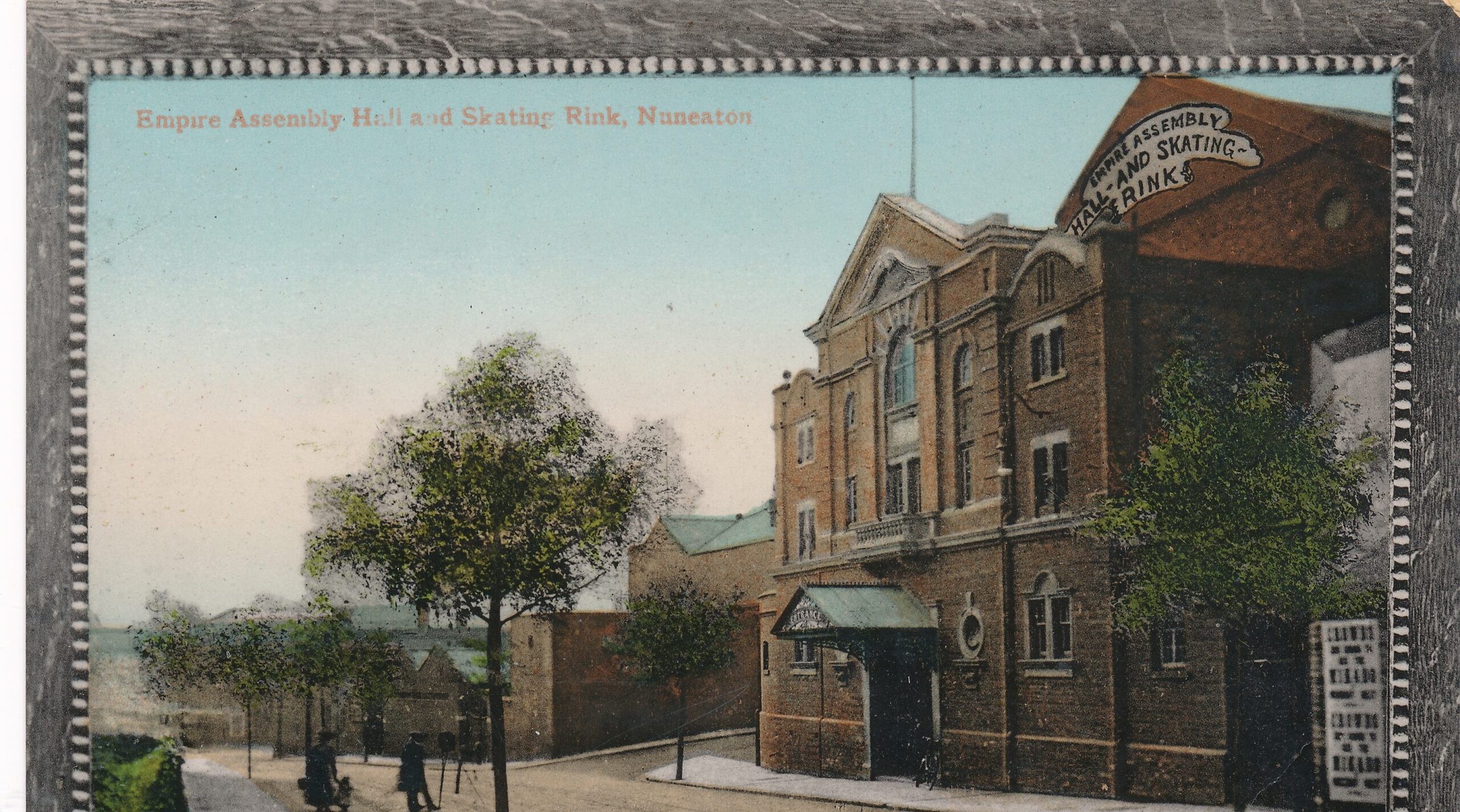
Rare postcard of the Empire Assembly Hall and Skating Rink on Leicester Road Bridge. The card is postmarked 1908. The rink eventually became a garage and then a warehouse for Debenhams before transitioning into Sports and Leisure under the Nuneaton and Bedworth Leisure Trust and now called The Empire Gym and Studios.
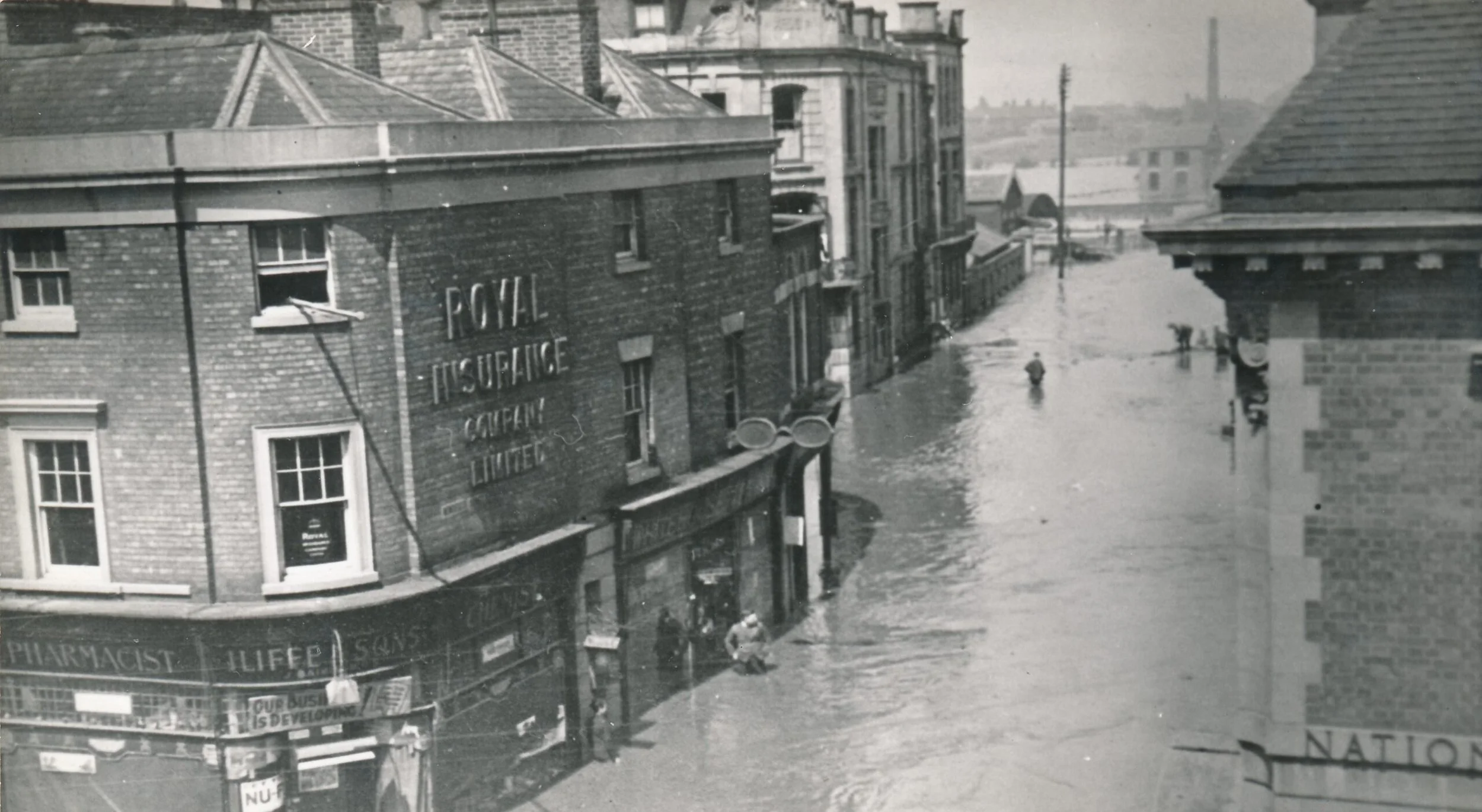
Photo taken from Barclays Bank of the May 1932 floods. The view is down Newdegate Square where the statue of George Eliot now stands. You can see the Newdegate Arms Hotel just behind Iliffes Chemist and behind that the Cattle Market.
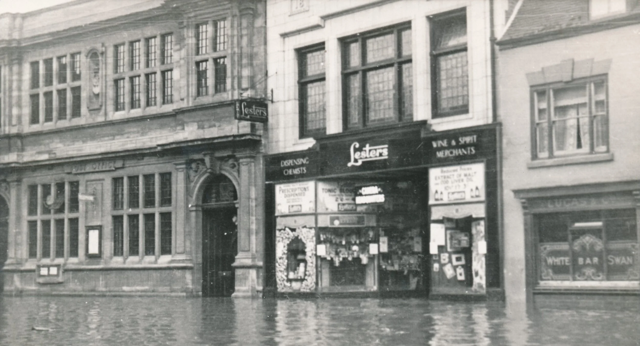
Bridge Street in the May 1932 floods. Lesters Chemist stands next to the old Post Office, approximately where NatWest is now.
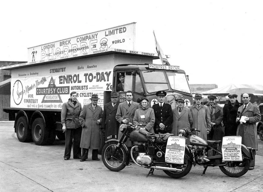
Courtesy Club road safety campaign in 1952, including 'Monty' Moreton (of 'Monty's Bus's' fame) and Mr Wright.
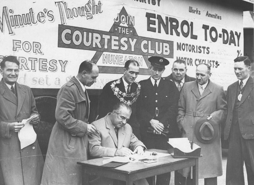
Mr Frank Bowles MP enrolls in the presence of the Mayor of Nuneaton (no NBBC back then) Councillor W. G. Corbett and other officials of Nuneaton Courtesy Club. December 1952.
Donate to Collection
In this section:
-
Our Museum
-
Our Building
-
Collections
-
Shop